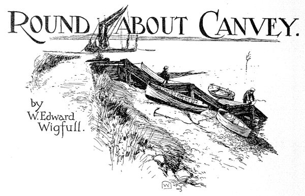
Small Craft
Late 19th & Early 20th Century British Yachting
The Sailors: Amateur British & Irish Yachtsmen Before World War One
YEARS ago, when I was working for a big London daily newspaper, the Editor one day called into his office a rising journalist and congratulated him on an article he had just written on " Life in a Destroyer "-it was at the time of the Russo-Japanese War-and finished up by asking him where he had got his facts. Now the journalist, though rising, was very, very young, and he replied, "Facts? I hadn't any facts."
Unfortunately for me, the occupant of the editorial chair of the YACHTING MONTHLY not only desires " facts," but carries his eccentricity as an editor further, by insisting on the facts being actually personal ex- periences of his contributors. It was in the attempt to gratify this whim that the series of mishaps, here following, occurred; there- fore I lay the blame on his shoulders. We determined to "discover " for our- selves the way to Benfleet; many times had we dodged about the entrance, and even hesitatingly penetrated as far as the old oyster watch boat, but not beyond, fearing the hidden mud. So we fixed on a day a week in advance for the venture. When it name it was a dull morning, but with a nice breeze about S.W. By making a good tack straight out from the shore at Leigh, we should be able to fetch up the greater part of the way on the next. High. tide about 12.30, which would give, a nice sufficiency of water, my boat drawing about 2 ft. io ins. I can see the average reader smile, but we measure our draught in inches in this locality. This very day of writing, that two inches lacking of three feet enabled us to creep up to our moorings.
The crew consisted of my wife, sister-in- law, small daughter and myself, and, . of course, we got away later than we intended;.. The long tack out came off as per pro-. gramme, but no sooner were we round on the other, than the wind became westerly, dead ahead. However, we determined to keep on. The first part of the creek is fairly wide, and there was plenty of water, so, carefully sounding with the boathook inshore, we got. along very well. As the creek narrowed, the tacks became shorter.' -(" Why don't you go straight instead Of wiggly-waggling all over the place like this?" asked the junior member)-until .at last it was not worth while making fast the jib sheets on each board. A barge yacht, the ideal boat for these waters, was beating up ahead of us, and we were gratified to find that each tack brought us nearer to her-in spite of the fact that she could hold on much further inshore. This proved our undoing, for, coming about close under her lee, we held on further than we should in the hopes of clearing ahead at the next meeting. Our boat came round all right, but a little spur of mud, outlying, caught and held us. It was, of course, just on the top of the tide, and, after exhausting all known means of getting her off, we decided to abandon ship. So, after tidying up the gear and laying out the anchor, we piled ourselves and personal luggage into the dinghy and started to row home. Unfortunately the opening of Leigh Creek tempted us. If we could get through, it would save a mile or so. Cautiously we tried-there was plenty of water-until we found the "watershed " was about 200 yards inside, and we could go no further. The water was dropping behind us; it was too late to row the laden boat back. Six feet or so of mud separated the dinghy from the bank, so I prepared to carry the ladies across. This method of debarkation is also one of the common features of yachting in the Thames Estuary, so we were used to it. But, alas! the mud here was much softer than at our moorings, and the weight of the first passenger drove my feet too deeply in for recovering. I lost my balance and fell. Happily the lady-it happened to be my sister-in-law-managed to keep on her feet, and struggled through. Hastily scraping the outer coats of mud off-moments were precious if we did not want to leave the dinghy, too-I placed stones for the others to gain the shore. Then I started to wade back, pushing the boat in front of me. Suddenly I trod in a deep hole, and the water caine up to my waist before I managed to throw myself across the stern of the dinghy. Of necessity I had to climb aboard; naturally the lunch and our coats were in the stern sheets, so that so soon as I put my knee on the stern, the water out of my high boots emptied itself indiscrimin- ately amongst them. Out again in the main creek, I collected the passengers from the sea wall, and we just managed to save our tide on the moorings.
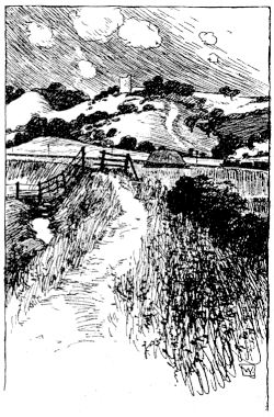
A Canvey Road, looking towards the River.
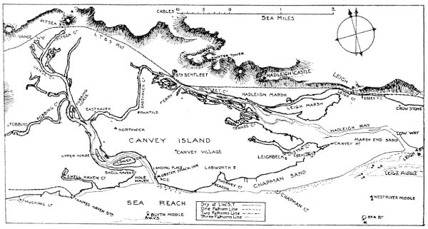
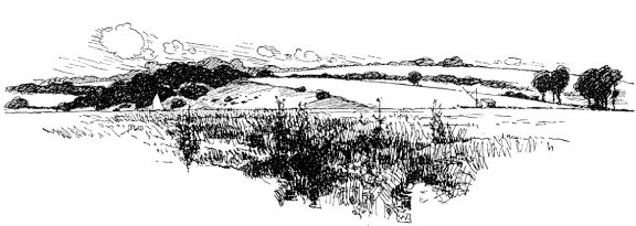
It will be at once apparent that this district offers to the " ditch crawler " all his joys. The up-river man, anxious to try his luck on tidal waters, will find the creeks at the back of Canvey easy of access, and affording plenty of sheltered water, which he can vary by having quite a consider- able "dust up" on occasion in Sea Reach if required. The owner of a big boat can lie comfortably either in Hole Haven or in the Ray off Leigh, whilst making side trips in his dinghy. The stranger anchoring in the Ray should look out for a large "horse" (not marked on the Admiralty chart) that runs up the middle of the lower end, and which dries out about two hours before low water. The bawleys anchor in line at either side of it, and consequently are a good guide as to its position. As will be seen from the map, there are two principal navi- gations: One from the Ray to Hole Haven, via Benfleet; the other up the creek to Vange, with its branch to Fobbing. The first is very popular with local boats, and it is possible with a fair wind to get round the island and back to moorings on the one tide, even in a 12 ft. dinghy.
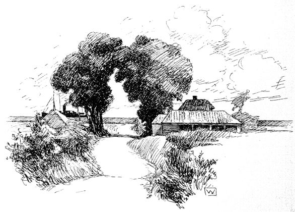
Above Benfleet: The Watershed.
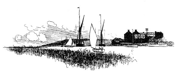
Starting from Canvey Point, the deep water keeps fairly to the middle, the channel being marked on the starboard hand by tree beacons. This is chiefly for the benefit of barge traffic, and a light draught boat can "borrow," being considerably on that side. A tree beacon on the port hand marks the end of a spit of mud by the entrance to Tewkes Creek. At this the channel crosses to the north side of the creek and keeps fairly close to' that bank for some distance past the Salvation Army cranes, which form a prominent feature in the landscape here- abouts. Leigh Creek joins in behind some islands below the cranes, but has only sufficient water on the top of spring tides for even a small boat. The port bank must be treated with respect, as the saltings are covered at springs, and the width is, in~ consequence, very deceptive. Some three hundred yards past the cranes the channel slants across to the south bank, and is very. narrow, the mud to starboard being marked with bushes. This continues right to Ben- fleet. At the Ferry the channel gets into the middle again, bends towards the north bank past the station, and thenceforward keeps fairly to the centre. The "water- shed " is a little beyond Benfleet, the tide ebbing through both Hole Haven and the Ray.
The Ferry, Benfleet.
Through East Haven Creek the channel continues in the centre, swinging to the outside of the curve round any points in the usual way. Once into Hole Haven there is plenty of water.
Apart from its sheltered waters, the district is well worth a visit. The sea wall on the south side of Canvey divides two worlds. On the one side deep water almost to one's feet, with the variety of craft from
Apart from its sheltered waters, the district is well worth a visit. The sea wall on the south side of Canvey divides two worlds. On the one side deep water almost to one's feet, with the variety of craft from